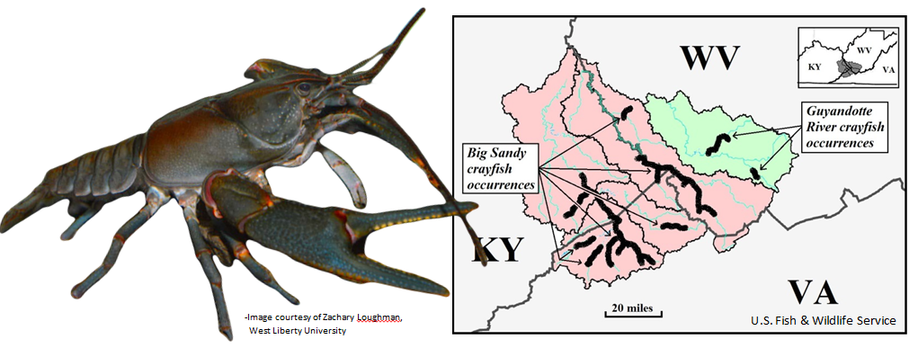
The Big Sandy Crayfish (Cambarus callainus) resembles a miniature lobster and is listed as a Threatened Species under the Endangered Species Act (ESA) of 1973. It is found only in the Big Sandy River Basin in within the states of Kentucky, Virginia, and West Virginia.
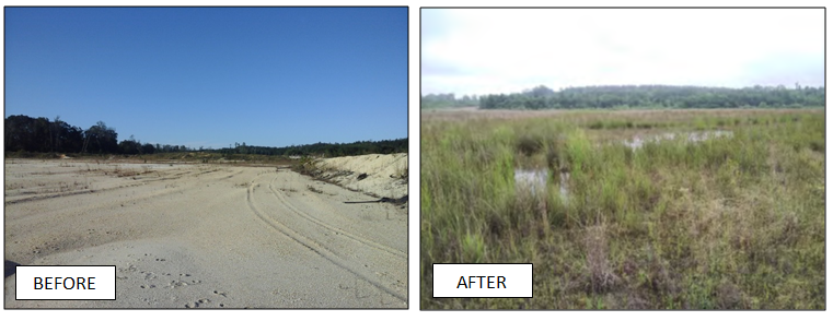
Waypoint personnel developed a 48 acre wetland restoration project to create 48 acres of bottomland hardwood wetlands in Autauga County, Alabama. To accomplish this, the first step has been grading to allow hydrology to be restored to the area. This has allowed hydrophytic vegetation and soils to be re-established.
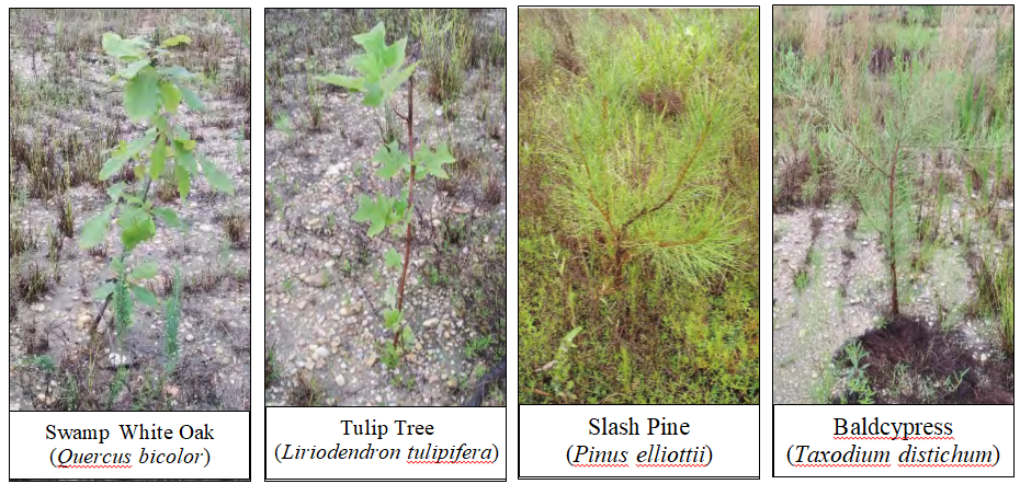
Various hardwood tree species have been planted across the site to help further establish the bottomland hardwood wetland type. Trees, shrubs, and ground cover help to stabilize the soil and decrease erosion at the site. Trees planted at the wetland restoration site are experiencing high survival rates and thriving in the newly adapted hydric soil conditions.
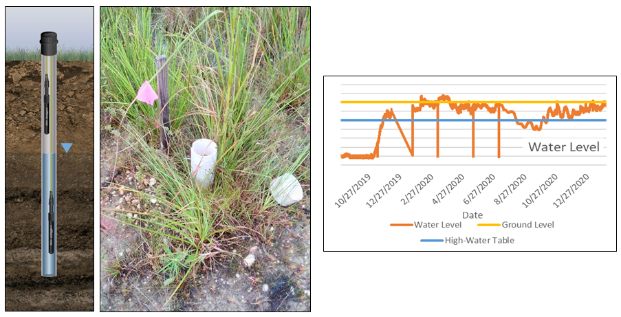
Leveloggers have been installed across that allow the tracking and documentation of groundwater levels, and soil saturation throughout the year. The data is then transferred to USB for use in further analysis of the success of the wetland.
Terrestrial zoology studies include deployment of acoustic bat detectors to record data to characterize the community of bat species present at the site.
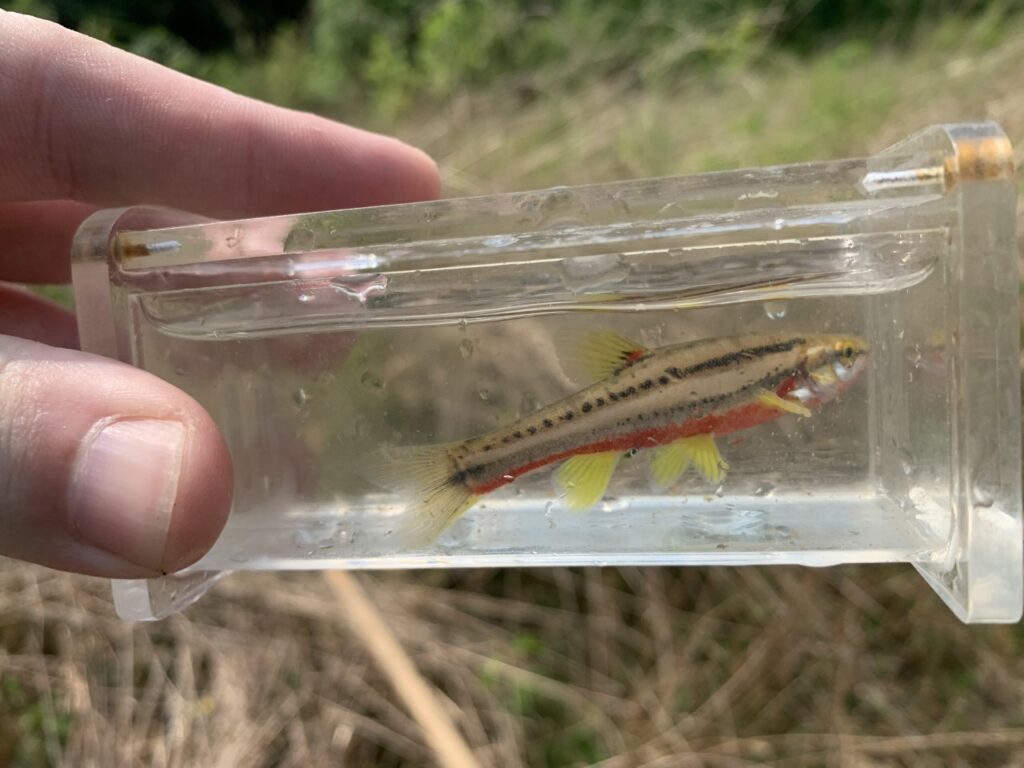
Last month we performed several fisheries studies to determine concentrations of metals. After the collection, the samples were placed in dry ice and shipped to a lab for analysis.
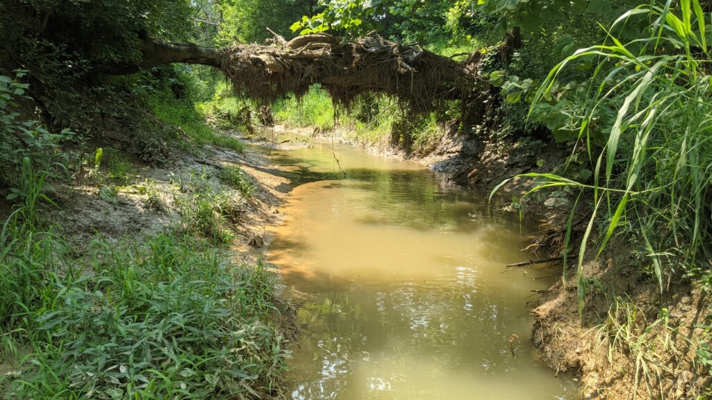
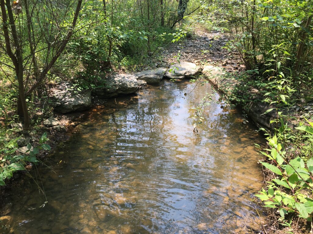
Last month we performed a fisheries study at a stream mitigation bank site. This data is being used to determine the Biotic Integrity Index to help measure the success of the restoration project. Populations of multiple fish species were found in pools just like these throughout the project.
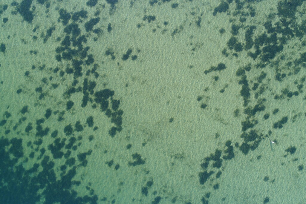
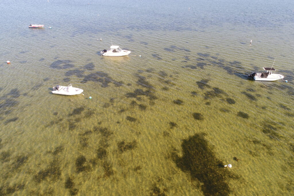
Eelgrass (Zostera marina) Restoration Monitoring with UAV
Eelgrass beds provide food and habitat for blue crabs, young striped bass, bay scallops, waterfowl, and many other aquatic species. The beds also filter pollutants, reduce shoreline erosion, trap sediments, and add oxygen to the water.
2021 Data Acquisition Details
The aerial submerged aquatic vegetation (SAV) imagery from Nantucket Harbor was acquired from a UAV at an approximate altitude of 200 feet.Camera settings were selected by automatic exposure control. Flight lines and frames were designed 80% line overlap and 70% sidelap.
Wind
Imagery was acquired during periods of no or low wind. Atmospherics Imagery was acquired during periods of no or low haze and/or clouds below UAV.
Sensor Operation
Photography was acquired in the vertical mode.
Tidal Stage Imagery was acquired at low tide.
Low elevation aerial imagery is the main source of information used to assess distribution and abundance of SAV in the Nantucket Harbor restoration plot.
Aerial imagery frames were then orthorectified to create orthophoto mosaics. These mosaics will be examined on-screen and outlines drawn to identify all SAV beds visible on the photography, providing a geographic information system (GIS) digital database for analysis of bed areas and locations
New Growth Occurring from Transplanting Eel Grass Monitoring Site
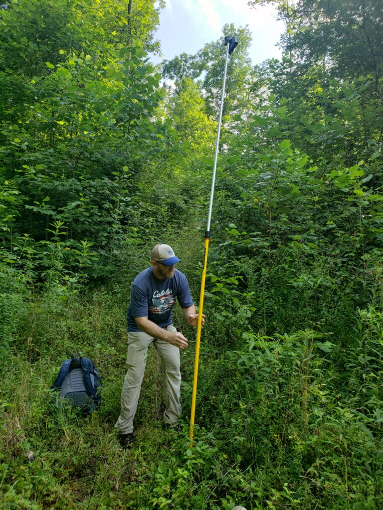
Stream discharge is the volume of water flowing through down a stream. The discharge rate is typically calculated in cubic feet per second or gallons per day. In this photograph we are measuring the discharge of East Hickman Creek by multiplying the area of water in the channel cross section by the average velocity of the water in that cross section.
During this fish survey, Waypoint personnel used a backpack electro-fisher to conduct a population census and identify the diversity of fish species in the stream segment. Contact us or request a quote today.
Section 404 Clean Water Act Mitigation compliance documentation can be very difficult due to the complexity and detail of many permit conditions. Waypoint, LLC specializes in regulatory compliance assistance and its personnel have been monitoring mitigation sites in multiple states for many years.